Maps are a time trap for historians…just ask the folks at the Kelley House Museum. A map inspection can turn from a quick glance to an hour or more of in-depth inspection, often with the assistance of a magnifying lens. And what captures this author is the names on the land. For whom, and what, was a placed named, and what work took place there.
This will be a two-part series with place names from Needle Rock on the Humboldt County border to Noyo explored here, and Caspar to Gualala in a future issue.
So here’s my suggestion…plan a Sunday drive with this column clipped out and in hand and go explore the Mendocino Coast. With just over 90 miles to cover there are more than 50 place names recorded, and those names do not include creeks or mountains. Indigenous peoples, settlers, and physical features have all left names on the land.
To be REAL adventurous doing this drive, modern day explorers have to take Highway 101 up to Garberville and head west towards Briceland and the Sinkyone Wilderness State Park. When you reach the ocean, you are at the very northwest corner of Mendocino Coast at a place called Needle Rock. It was named for pointy rocks in the vicinity.
At Bear Harbor just to the south, tan oak bark was loaded on ships to go to leather tanneries in the Bay Area. Bears were probably seen at Bear Harbor in the dim distant past.
The problem now is an area called the Lost Coast and Cape Vizcaino because there are NO roads along this part of the coast. Travelers head south on Usal Road in and out of view of the ocean. Usal was a native Pomo word meaning “south.” There was one place name on the land at Jackass Creek and a small lumber mill and town called Wheeler during the last century.
Shipping points and landings abounded on the coast, usually named for the landowner. There was one called Miller, now inaccessible on private land, before Usal Road joins Highway One along Cotteneva Creek. Cotteneva was a Cahto native word meaning “trail-goes-over-hill” and it was used along with the name Rockport. Rockport had a wharf, a mill, and was indeed a rocky port.
Hardy, or Hardyville, was a property owner’s name and south of that was Union Landing, now part of a state park. De Haven was named for John DeHaven, an early settler, who became district attorney, state assemblyman, and senator in the 1870s.
Westport used to be Beall’s Landing and was later named Westport because a lumberman came from Eastport, Maine, and figured there should be a Westport too. Chadburne Gulch was named for the owner and has a free access road to the beach.
South down the road was the town of Kibesillah (a native Pomo word) and beyond that was Newport…the “new” port. A curve in the road had Abalobidah, another Pomo place name.
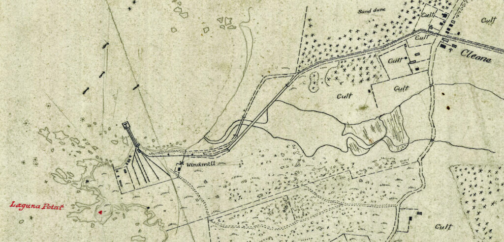
Cleone is Pomo also, though the point shipping took place from was Laguna Point, a Spanish word. Pudding Creek was either murky like mushy pudding, or a slang version of “Put In” creek where boats were launched.
Fort Bragg’s name comes from Braxton Bragg, a military officer, but Noyo is again Pomo. Caspar was named for Siegfrid Caspar, who settled there before 1860.
Want to know more about our place names on the land? David Durham wrote “Durham’s Place-Names of California’s North Coast” and Erwin Gudde’s “California Place Names’ available for review at local museums and libraries.
Let’s continue our trip down the coast in next week’s column!